
Bengaluru’s Expanding Road Network: Which Farmland Corridors Are Becoming More Accessible?
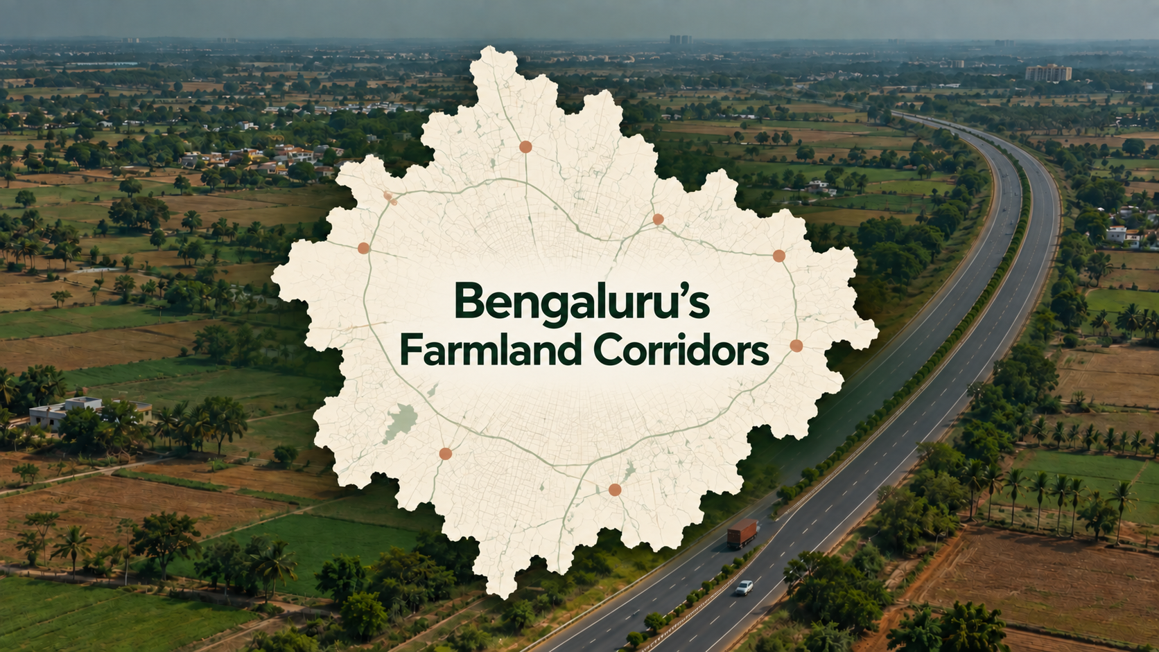
A farmland project can look close to Bengaluru on a map and still take considerable effort to reach. City traffic, highway exits and the final village road all shape the journey.
That is why Bengaluru’s expanding road network matters to farmland buyers. Better connections can make weekend visits easier, help owners stay involved in farm activities and improve access for workers and supplies.
But the benefits vary by location. Some road sections are already usable, while others remain under construction or await approvals. Even within the same corridor, two projects can have very different access.
For buyers exploring infrastructure corridors for farmland near Bangalore, the useful question is: which road actually improves the journey from your home to the project?
Road-project information below reflects sources reviewed in September 2026. Completion targets should be checked again before planning a purchase or site visit.
What Better Road Connectivity Means for Farmland Buyers
Accessibility influences how farmland fits into everyday life. A manageable drive can make it easier to visit regularly, supervise maintenance or spend a weekend with family.
For agricultural use, access has another purpose. The road must accommodate the people, equipment and vehicles needed to operate the farm. A comfortable car journey does not necessarily establish that a tractor or produce vehicle can reach the plot.
Think of the journey in three parts: getting out of Bengaluru, travelling along the main corridor and reaching the farmland from the nearest usable exit. A highway improvement may help the middle section while leaving the other two unchanged.
1. Dobaspet–Doddaballapur–Devanahalli: An Established STRR Connection
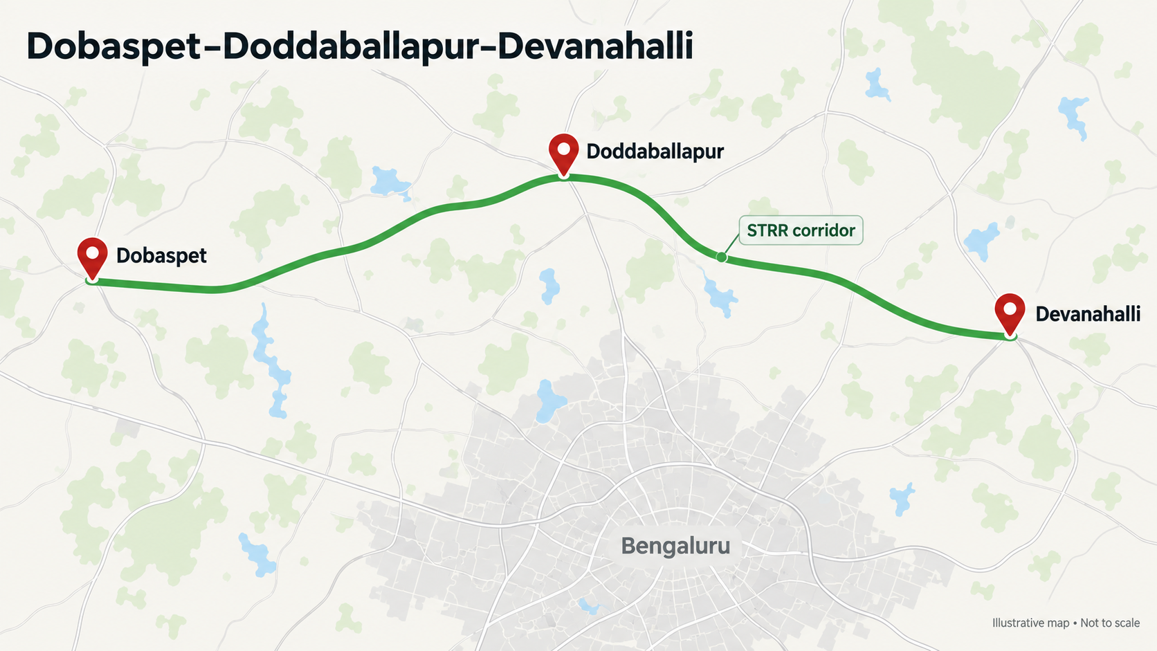
The northern section of the Satellite Town Ring Road, or STRR, is one of the clearest examples of infrastructure that buyers can assess on the ground. The Union government’s road ministry records the inauguration of the Dobaspet–Hoskote project, which forms part of this outer connection. pib.gov.in
For farmland searches around Doddaballapur and the wider Devanahalli belt, this creates another route to consider alongside existing city-to-highway connections. Its usefulness depends on where the buyer starts and where the project sits relative to an accessible junction.
A buyer travelling from northwest Bengaluru may experience the corridor differently from someone leaving Whitefield or Electronic City. The same project should therefore be assessed using the buyer’s actual starting point.
During a site visit, check the drive from the STRR exit to the project gate. Ask whether the route uses a public road, passes through a village or depends on a private access arrangement. This final stretch often determines how convenient regular visits will be.
2. Hoskote–Malur–Bangarpet–Bethamangala: An Operational Expressway Section
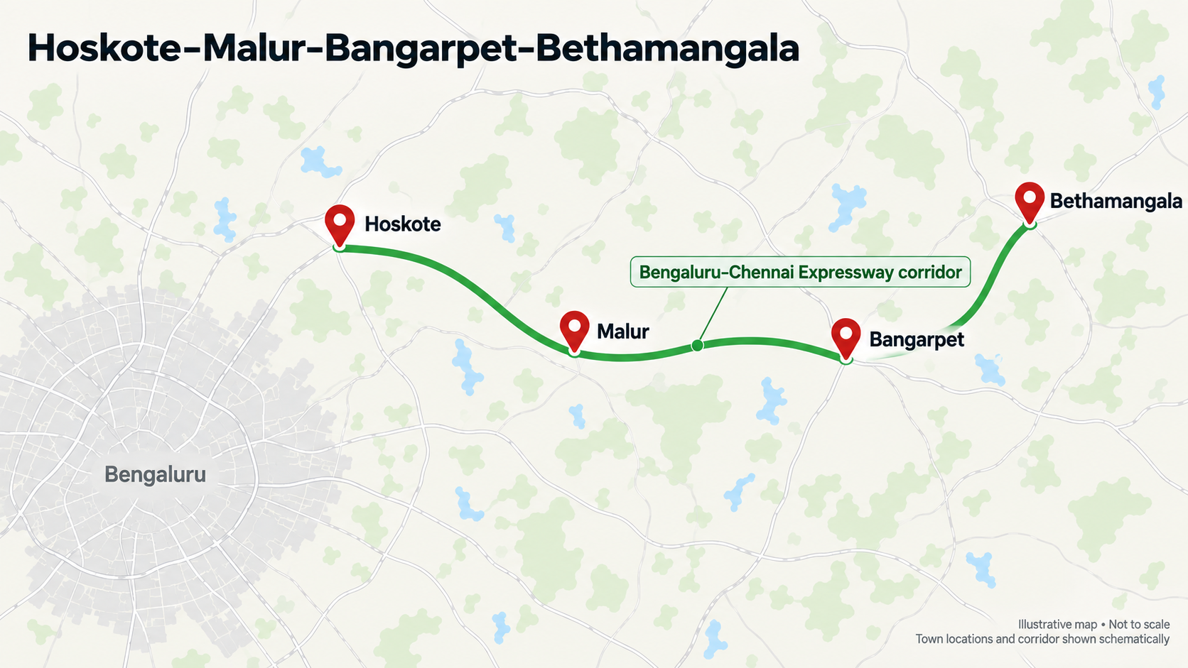
The Bengaluru–Chennai Expressway adds an important connection east of Bengaluru. An August 2026 report on a parliamentary response described the 71.7-kilometre Karnataka section as operational, covering the Bengaluru–Malur, Malur–Bangarpet and Bangarpet–Bethamangala packages. The same report said the government had not provided a clear opening date for the entire Bengaluru–Chennai route. The Times of India
This makes the eastern belt relevant when comparing farmland access through Hoskote and towards the Malur–Bangarpet region.
However, an access-controlled expressway can only be entered and exited at designated locations. A project described as “near the expressway” may still require a substantial drive to the nearest usable interchange.
Ask the seller to share the exact project pin and the interchange used to reach it. Then check the full route. Straight-line distance from the highway is a poor substitute for the journey a buyer will actually make.
For these locations, evaluate the benefit of the open Karnataka section separately from expectations about the completed inter-state expressway.
3. Devanahalli–Chikkaballapur–Nandi Hills: Check the Connection Beyond the Main Highway
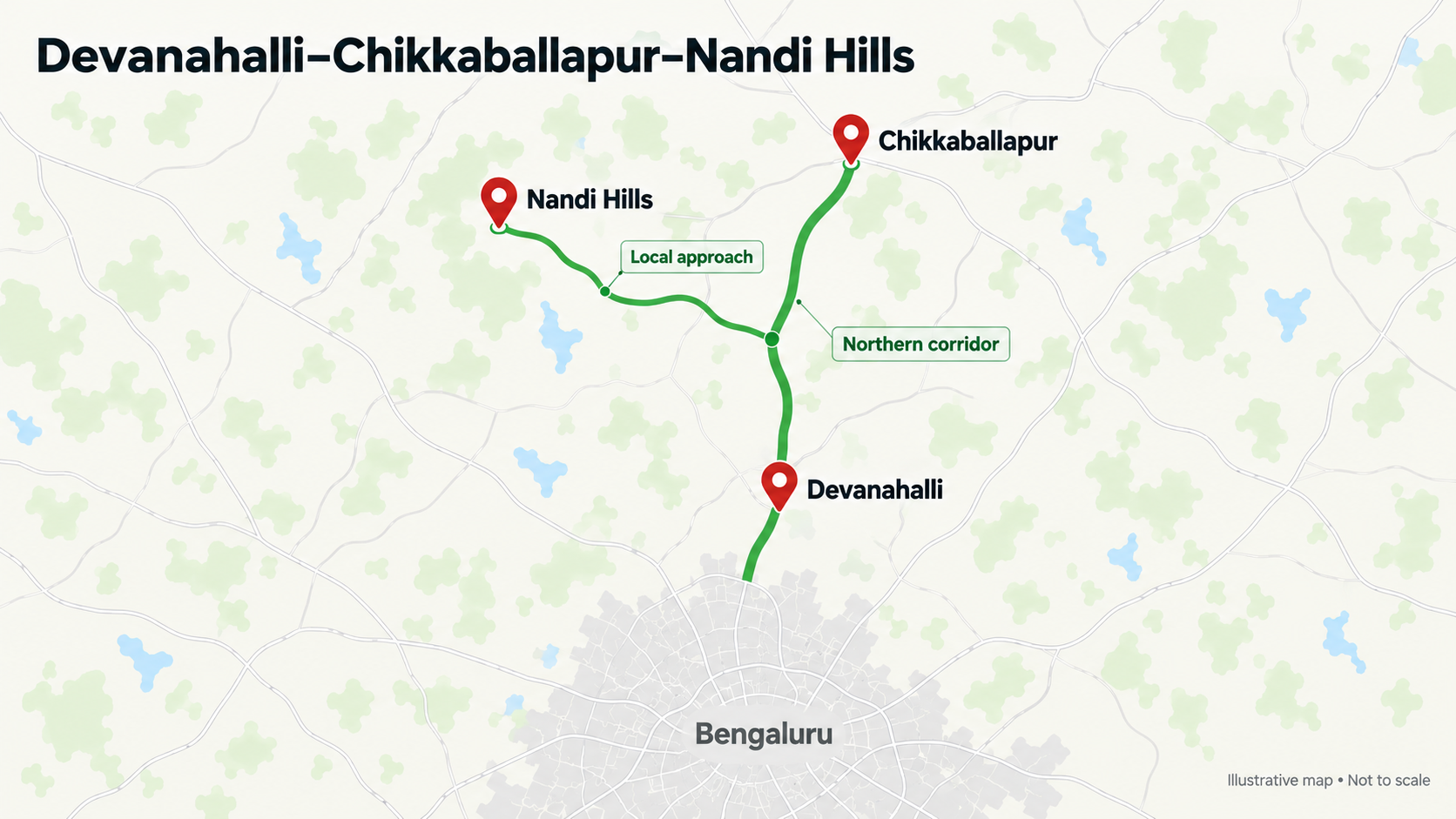
Farmland around Chikkaballapur and the Nandi Hills region should be assessed through its actual connection to the northern road network.
The practical question is how a project connects to the main route. A location reached through a straightforward turn-off and a well-maintained village road can offer a different experience from one requiring several narrow roads and detours.
This is especially relevant for buyers who want frequent weekend use. Drive to the property at the time you would normally leave home, and assess the return journey too.
For managed farmland, ask how the farm team reaches the site, where supplies come from and whether access changes during heavy rain. These questions help turn a broad “North Bengaluru connectivity” claim into information you can use.
4. Hosur–Denkanikottai–Berigai: Watch the STRR Links, Then Check Each Local Route
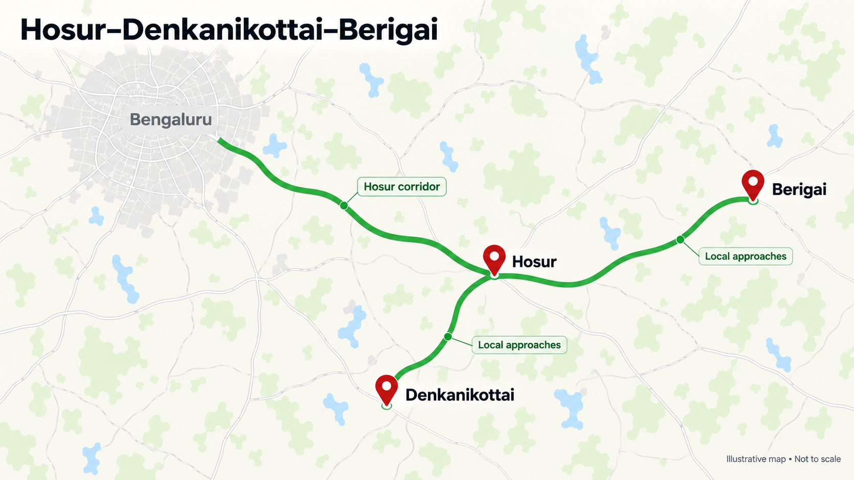
Hosur-side connectivity is another development to follow. Reporting in August 2026 indicated that around 144 kilometres of the STRR between Dobaspet and Hosur were targeted to become operational by the end of November 2026. At that stage, connecting sections remained under construction. This was a target, rather than confirmation that the complete route was open. The Times of India
For farmland around Denkanikottai and Berigai, the potential benefit needs a project-level assessment. A new connection near Hosur does not automatically shorten every journey into the surrounding countryside.
Denkanikottai and Berigai also require separate route checks. Ask which approach road serves the specific project, where highway traffic is encountered and how much of the journey takes place on local roads.
Treat any expected STRR benefit as an additional factor. The project should first be evaluated on the route available today.
5. Ramanagara–Channapatna–Maddur: A Highway Benefit Buyers Can Test Today
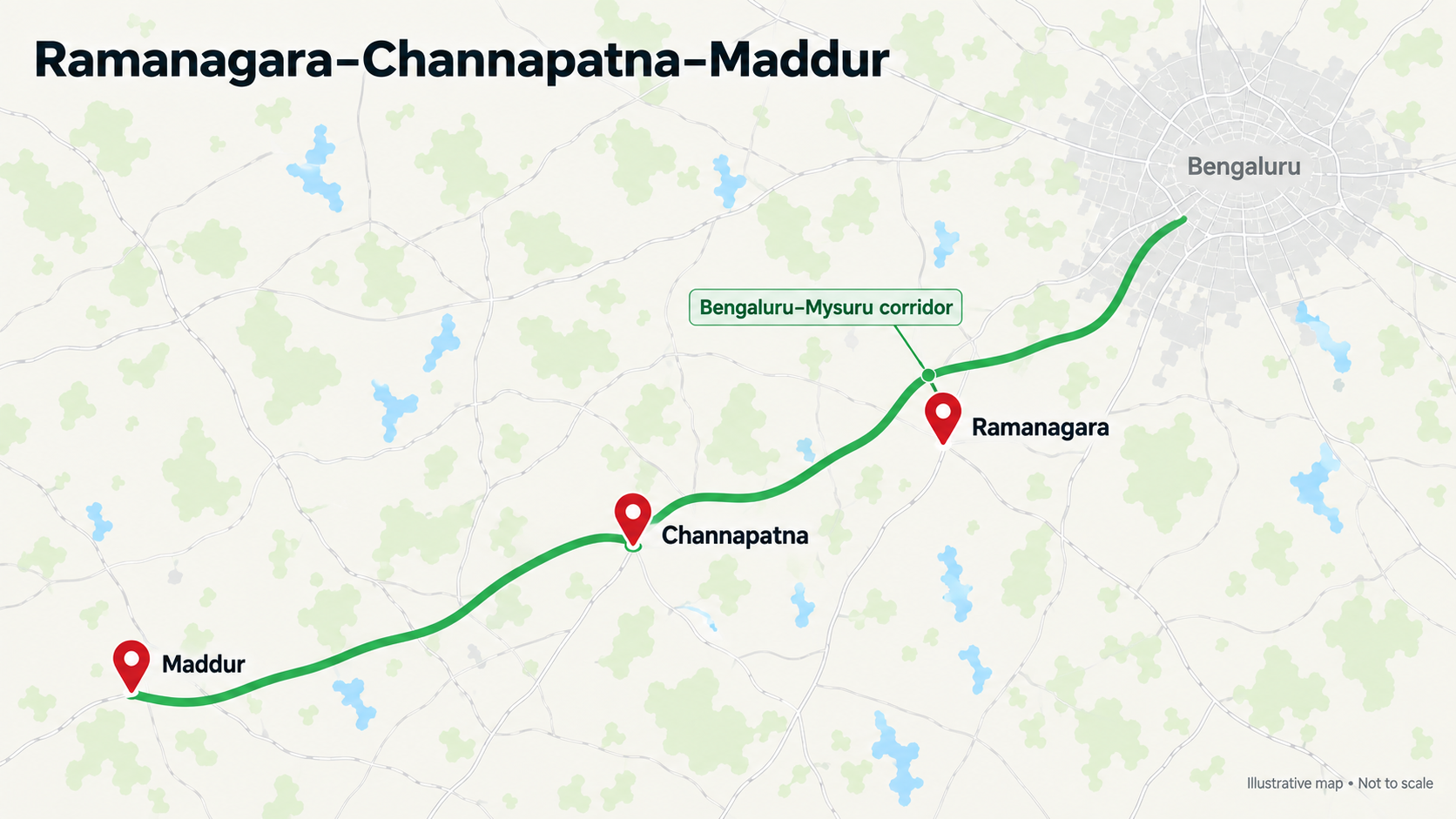
The Bengaluru–Mysuru corridor offers an established infrastructure reference. According to the road ministry, the 118-kilometre access-controlled highway opened to traffic in March 2023. pib.gov.in
For farmland searches around Ramanagara, Channapatna and Maddur, buyers can assess an operating highway rather than rely entirely on future completion dates.
The local connection still matters. Check the correct exit, any service-road travel and the distance from the highway to the property. A plot beside the highway may not have convenient entry, while a property farther away may connect through a more straightforward route.
For buyers based in west or southwest Bengaluru, this corridor is worth comparing through an actual site visit. Include tolls, city-exit traffic and the return drive when judging whether the journey suits regular use.
How to Compare Infrastructure Corridors for Farmland Near Bangalore
Start with your home location and the frequency of visits you expect. A project intended for weekly family visits needs a different accessibility standard from land you plan to inspect occasionally.
Request the exact village name, project entrance pin and nearest operational highway exit before shortlisting. A general location label such as “near Devanahalli” or “off Hosur Road” leaves too much room for variation.
Next, separate existing infrastructure from future improvements. Ask the seller to identify the specific road section being discussed and whether it is open, under construction or proposed. If a future connection is central to the sales pitch, ask how the project is reached without it.
Finally, inspect the approach road. Look at its surface, width, drainage, lighting and ability to accommodate passing vehicles. Where access crosses private land, have the access arrangement independently reviewed.
Does Better Connectivity Mean Higher Farmland Prices?
Improved access can make a location more convenient and broaden its appeal. However, road development alone is not enough to establish what a particular farmland project is worth.
Compare properties with similar land characteristics, access, water availability and management arrangements. An asking price for a managed plot may include services or development costs that are absent from the price of agricultural land nearby.
Ask the seller to explain the price using current project features. If part of the premium is based on an upcoming road, understand whether that benefit is already reflected in the asking price.
This makes it easier to distinguish the value of usable infrastructure from expectations about future development.
Find a Corridor That Fits How You Will Use the Land
Bengaluru’s road expansion gives farmland buyers more routes and locations to investigate. The northern STRR connection, the operational Karnataka section of the Bengaluru–Chennai Expressway and the Bengaluru–Mysuru highway provide concrete starting points. Further STRR links may expand those options as sections open.
Use the corridor to narrow your search, then assess each project through its exact location, approach road, water arrangements and available documents.
Explore farmland projects on Farmland Bazaar, request the location and access details, and plan a site visit that covers the entire journey—from your doorstep to the farmland gate.
Written by Farmland Bazaar Team
Agricultural assets advisor contributing to Farmland Bazaar v2. Focusing on organic investments, soil analysis reports, and deed checks.